

2024 New Discoveries in Cornucopia Archaeology
Recently, the Samarkand Institute of Archaeology (Uzbekistan) has announced that it has made a new discovery in Sutra archaeology, as a possible Sutra temple has been revealed by archaeologists, along with material remains such as frescoes of idols, which has attracted a part of the academic world's attention.
The temple site, named Kurgon tepa (39°26' 57N.67°08' 59E) in the region of Urgut, 30 kilometers southeast of Samarkand, with a nearby village called Eshon-Ravot, has been under excavation since 2022 by the Samarkand State University in Uzbekistan ( Samarkand State University (Uzbekistan), New York University (NYU-BBAW), and Hokkaido University (Japan). Also excavated is a nearby site of Kuldor tepa (39°29' 38N, 67°10' 10E), 25 km from Samarkand, which has been excavated since 2023 and has also yielded results during spring and fall archaeological work. The two sites are approximately 5 km apart and are undergoing alternating archaeological work.
This is also the result of the archaeologists' continued exploration of the surrounding area, following the previous collaborative archaeology at the nearby Kafir kala Sut urban site in 2013, and provides additional information for the interpretation of Sut urban and social life. In particular, the Kafir Kala urban site has been inscribed on the list of UNESCO World Heritage Sites “Silk Roads: Zarafshan-Karakum Corridor” (joint nomination of Tajikistan, Turkmenistan and Uzbekistan) to be inscribed in 2023. (Silk Roads: Zarafshan-Karakum Corridor, a joint Tajik, Turkmen and Uzbek nomination), gave researchers further encouragement.

According to Chinese literature, the southwest region of Samarkand is “Zhaowu nine surnames” in the “rice” one of the candidates for the homeland, in the “Sui Book”, “New Tang Book” in the western region of the biography of the many records, especially the “New Tang Book - Rice Biography” recorded in greater detail: “100 miles north of Kang, its ruler ruled the city of Bali. “A hundred miles north of Miguosi, its ruler ruled the city of Boshide. It was destroyed by the Great Food in the time of Yonghui. Xianqing three years, to its land for the South Tranquillity State, authorized its king Zhaowu Kaiyun for the assassin, since then the tribute is unceasing.”
When Venerable Xuanzang of the Tang Dynasty passed through this place in 630, he recorded this place as “Repo Moga Kingdom” in his memoirs “Records of the Western Regions of the Great Tang Dynasty,” which was “four or five hundred miles in circumference, according to the middle of the river, east and west narrow, north and south long, and the soil is suitable for the customs.” Both Miguo and Repomoga are supposed to be phonetic translations of Māymurgh, so it is assumed that Miguo was located near the current confluence of the Zeravshan and Dargon rivers. In particular, the city of “Boshide” mentioned in Chinese documents, where the king of Miguén built his capital, was once captured by the Arabs during the Yonghui period of the Tang dynasty (ca. 654); the Tang dynasty set up a capital in this city in 658, and appointed the king of Miguén as Zhaowu Shouhou as an assassin; and thereafter, it was mentioned in the “Ruofu Yuangui” that the king sent several envoys to Miguén during the Kaiduan period (730-744), and then sent a number of envoys to Miguén from 730 to 744. In 744, it was mentioned that the king of Miguén had sent several envoys to the Tang Dynasty to pay tribute to the lions, dance feasts, jade jade piths, Hu Xuan dancers and other famous things from the western regions, so its historical importance is self-evident.
Therefore, the search for this documented royal city has become one of the goals of archaeologists working here. In the past decades, some scholars have considered the present-day city of Pajikent in Tajikistan to be a “potsherd” city, but in the last few years some scholars have questioned this.
According to al-Istakhri, ibn Hawqal, and al-Muqaddasi in 9th-12th century Arabic literature, there were still many small towns in the vicinity of the region during the Islamic era, such as Sanjarfagn, Maymurgh, Waraghsar, and twelve others, which belonged to Samarkand. Samarkand. Four of them are located in the south-eastern part of Samarkand, each 12-25 kilometers away from Samarkand, and some of them are used as palaces, satellite towns, and some of them belong to independent city-states. Maymurgh is one of the larger towns, and the smaller towns of Sanjarfagn and Waraghsa are under its jurisdiction. In the last two years, Uzbek scholars, after field research and comparison of documents, have concluded that the site of Kurgon tepa is the Sanjarfagn of the literature, and that the site of Kuldor tepa is Maymurgh, a view that is shared by some scholars.
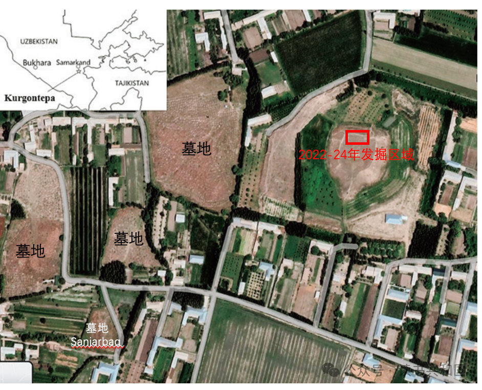
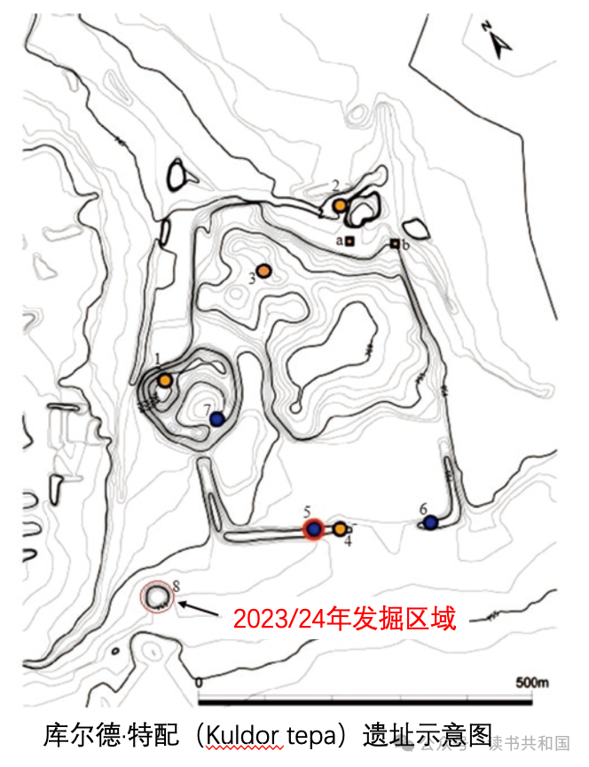
(Schematic map of the Kurugon-Tepai site©️村上智见)
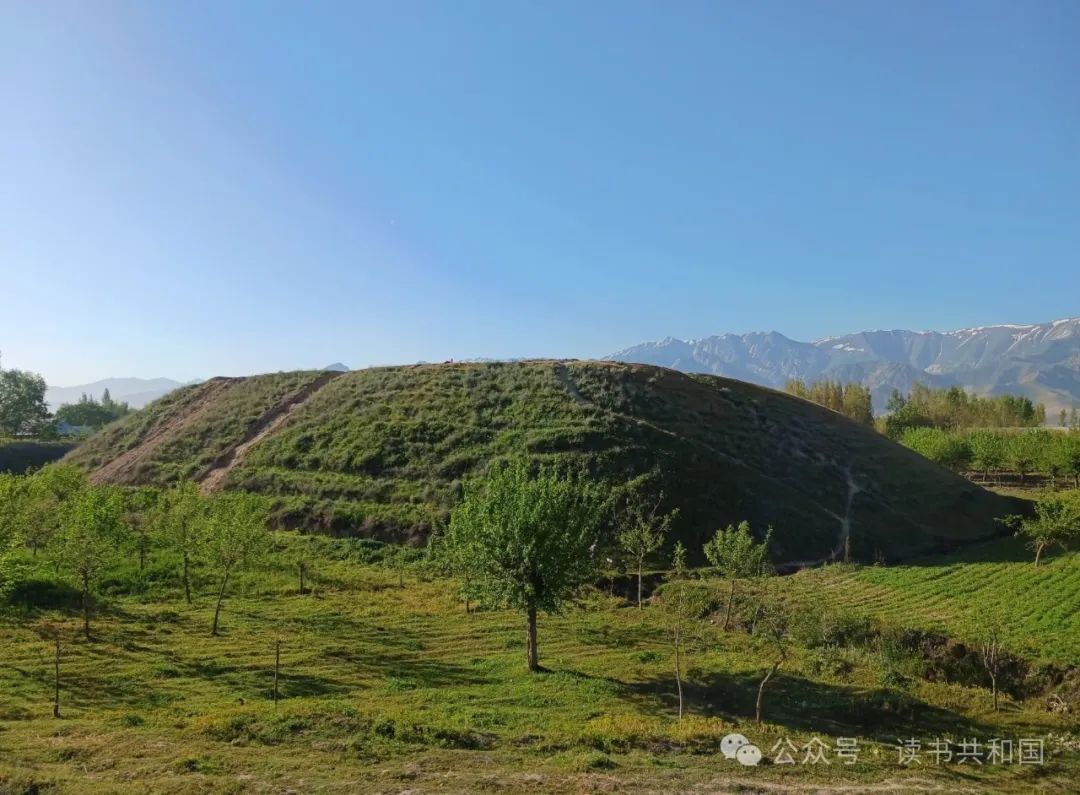
(Distant view of the Kurugon-Tepe site©️Alisher Begmatov)
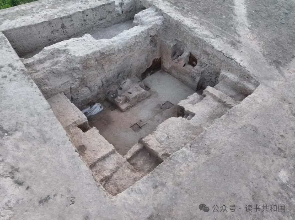
(the scene of an archaeological excavation©️Alisher Begmatov)
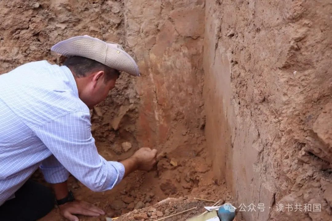
(Crews cleaning frescoes at the Kurugon-Tepe excavation site©️Alisher Begmatov)
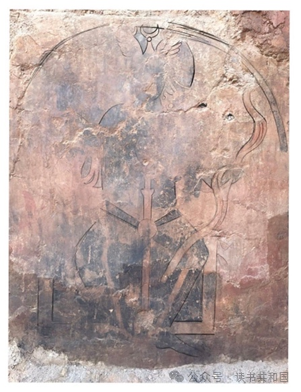
(A newly excavated mural depicting a figure holding a sword, wearing a bird-winged crown and a three-sided crescent moon at the site©️Alisher Begmatov)
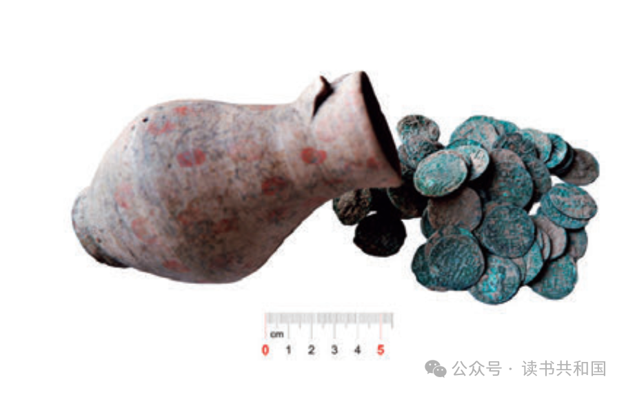
(Painted pottery pots and 87 silver coins turned in by villagers near the site©️村上智见)
Kurgon tepa is a complex of irregular square high mounds, the central mound being about 14 meters high, surrounded by residential houses and agricultural land. Nowadays, part of the mound is occupied by four cemeteries of the local people, one of which is called Sanjarbag by the local people, which is very similar to the pronunciation of Sanjarfagn in Arabic literature. The word “fagn” means “monastery” in the Cornish language, but whether it is a Zoroastrian or Buddhist monastery cannot be easily determined. In 2022, archaeological excavations were carried out in a new area of the site, and fire-scorched walls and pieces of Islamic ceramics were found. The bottom part of the site was judged to date from the 7th-8th centuries, but some of the buildings were restored in the 11th-12th centuries during the Chorasmia period. The archaeological activity was well supported by the local population and many public archaeological activities were carried out.
During archaeological excavations in July 2024, remnants of a fire pit-like structure were unearthed in the site building, as well as a fresco depicting a human figure on one of the walls. The figure bears a bird-winged crown with a three-sided crescent moon, which appeared in Persian Sassanid and Sultanid coins, and was popular in the images of the princes and lords of the Quetzalcoids (White Huns) and Sultans, and is often found not only in frescoes of Central Asia and Bamiyan, a figure that some scholars have attributed in the past to the legendary hero Rustam, and others to the god ἐāna Tienjin, whom Xuanzang had documented as the god of the heavens (Ž ūn), which was also imported into China and is commonly found as a decorative element in the tombs of incoming Sutis and Buddhist caves.
In any case, based on these material remains, it is highly probable that this architectural site was a Zoroastrian temple, and research is now in progress.
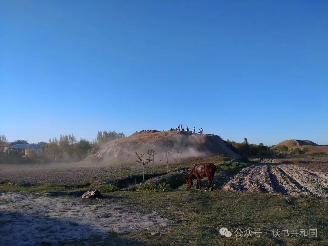
(库鲁贡·特配遗址远景©️村上智见)
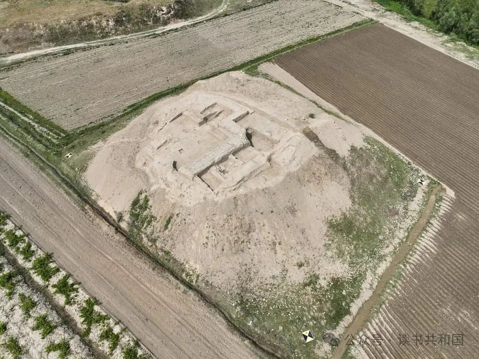
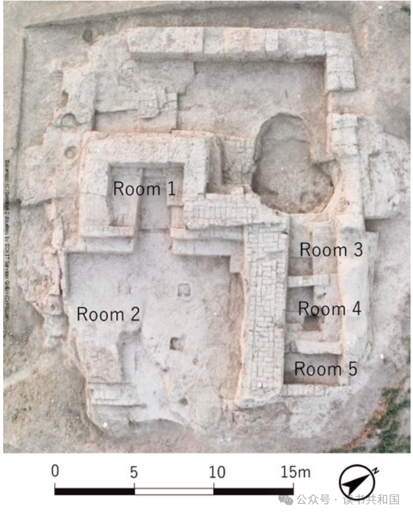
(Distant view of the Kurugon-Tepe site©️村上智见)
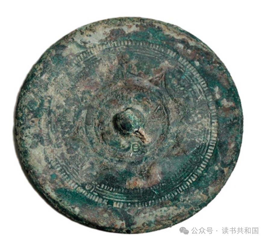
(Bronze mirror imitating China unearthed in ROOM1©️村上智见)
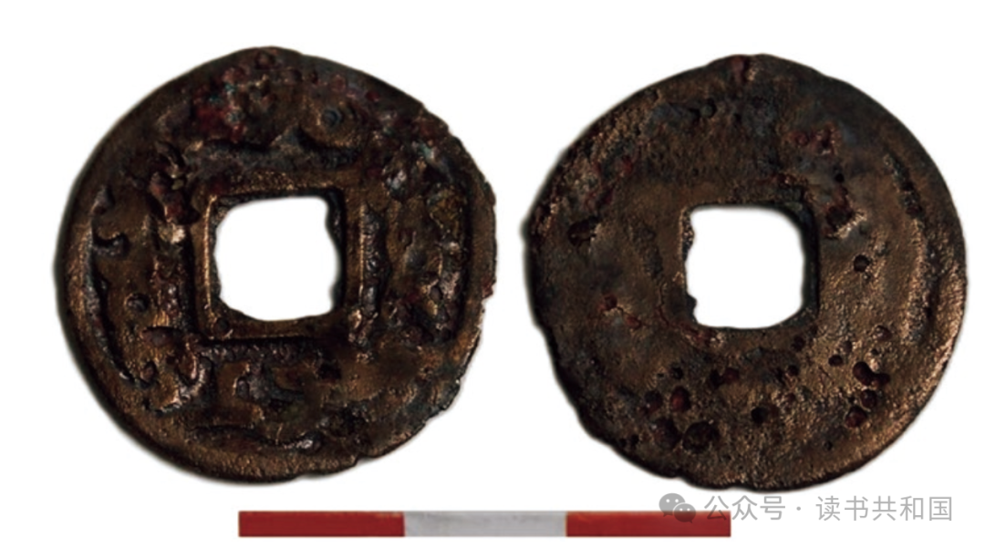
(Cornish copper coins unearthed at ROOM1©️村上智见)
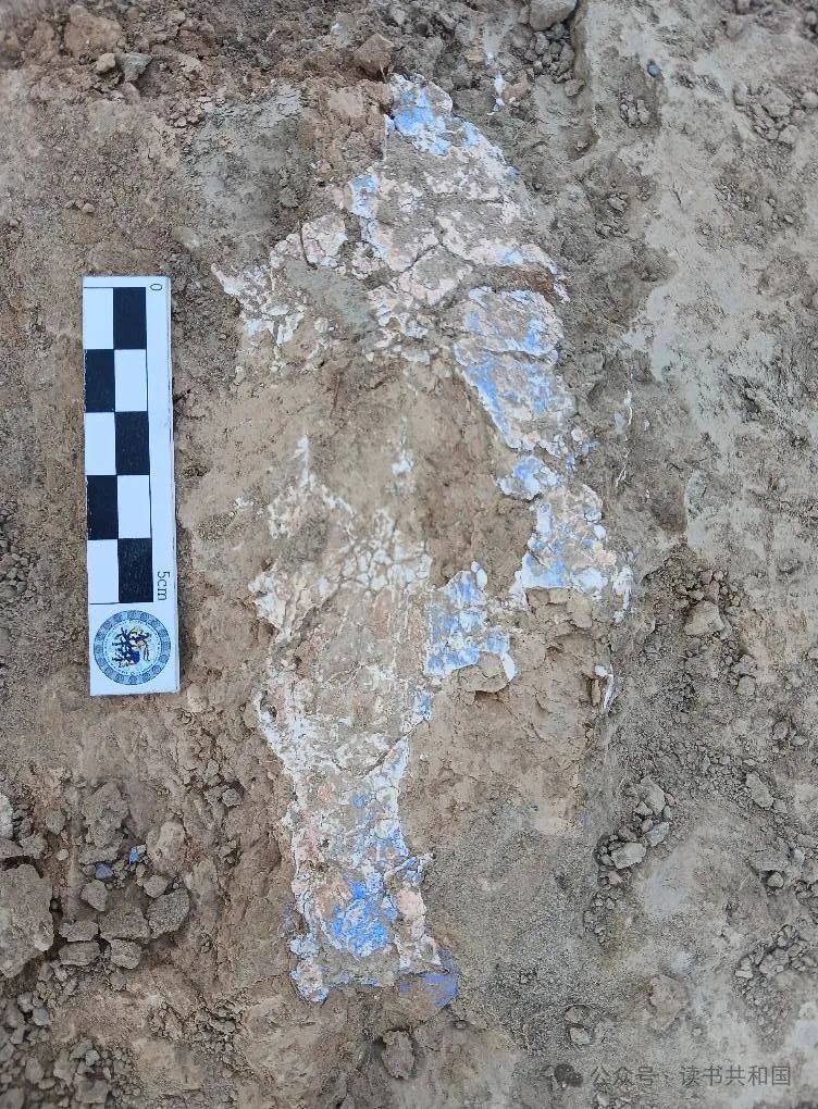
(Unearthed fresco fragments©️村上智见)
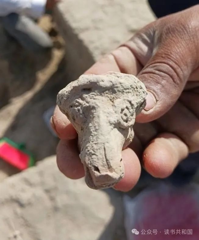
(Unearthed pottery remnants)
Kuldor tepa, which translates as “Slave's Mound”, is an unruly rectangular city with rounded mounds outside the walls that may be remnants of ancient commercial facilities. The site covers an area of about 17 hectares. The city “Baoshide” depicted in the New Tang Dynasty Book may be a reference to this city (another theory is that it is Katajikent). The site was first discovered in 1954 by the famous archaeologist V.I. Sarianidi, and continued excavations by the Soviet archaeologists Staviskiy and Urmanova in the later years established that the site was created in the 1st century, developed in the 3rd-4th centuries, flourished in the 7th-8th centuries, and the city was destroyed after the 8th century.
Archaeological work was restarted in 2023 on a circular mound about 115 meters in the southwestern position outside the city, which was 9.5 meters high and 27 meters in diameter, and revealed five houses built of day-dried clay bricks, constructed around the 6th-7th centuries, and initially hypothesized to have been a possible Zoroastrian bird burial platform (دخمه, Tower of Silence). In the 1st room unearthed stepped building remains, the ground has a long time fire drying traces, it is inferred that may be placed in the sacrificial fire container; in addition to the excavation of imitation copper mirror 1, corn coins two, in addition to the 1st and 2nd room unearthed a number of mural paintings fragments, mostly using white, blue, red pigments and other paintings.
For further research, please follow the work of archaeologists such as Begmatov Alisher, Tomomi Murakami, Sandiboev Alisher and others.