

Successful inscription of the “Silk Road: Zerafshan-Karakum Corridor” on the World Heritage List
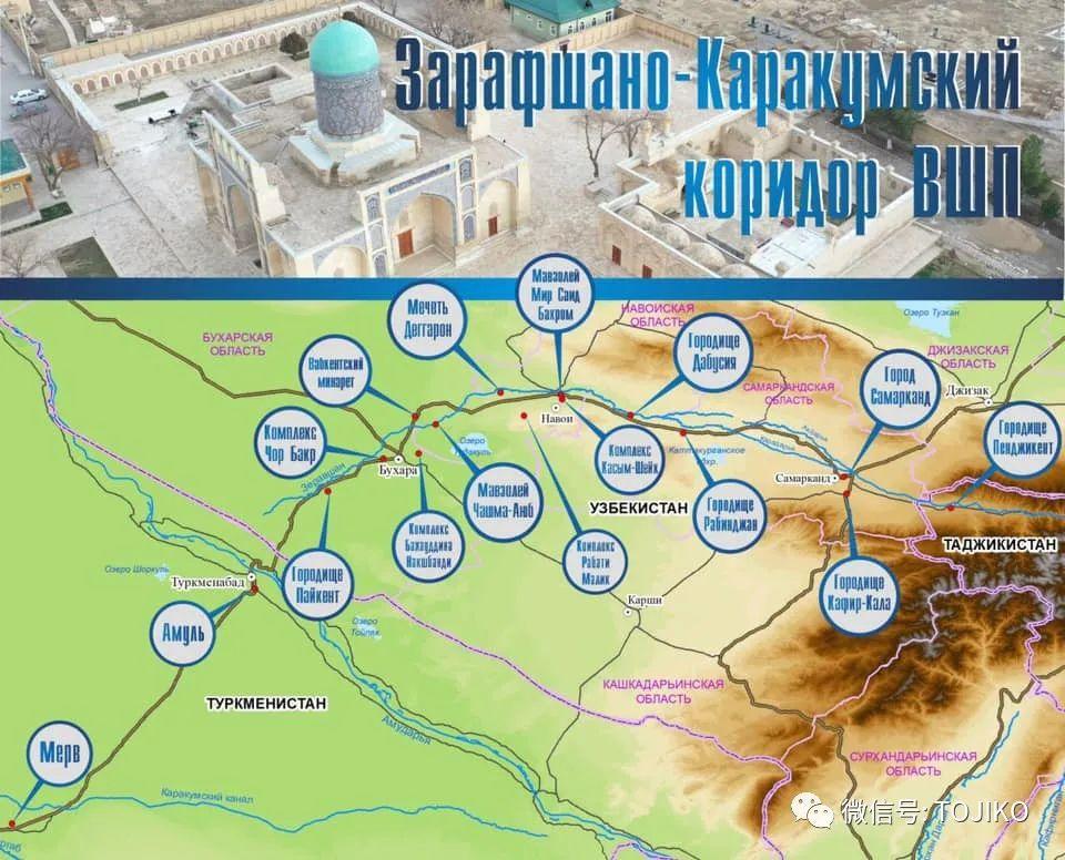
On September 17, 2023, the project “Silk Roads: The Zerafshan-Karakum Corridor”, jointly nominated by Tajikistan, Turkmenistan and Uzbekistan, was recommended for inscription by the Advisory Bodies, and was examined by the World Heritage Committee and successfully inscribed on the World Heritage List, in accordance with the criteria of Outstanding Universal Value (ii), (iii) and (v). (ii) (iii) (v) of the criteria of Outstanding Universal Value.
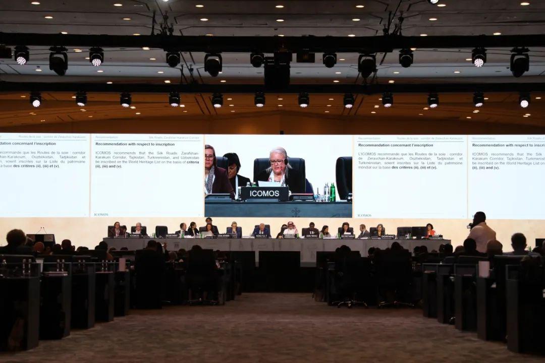
Scene of deliberations of the General Assembly
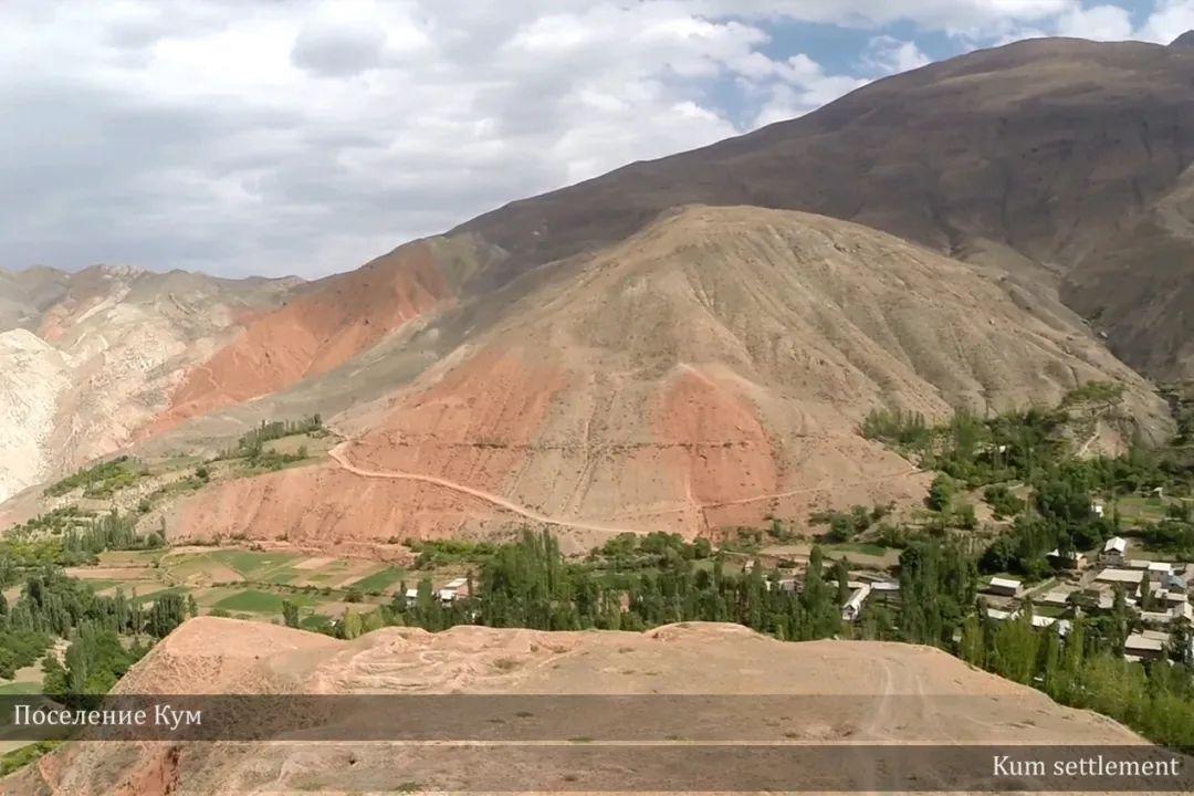
Silk Roads: Zerafshan-Karakum Corridor “Kum Colony” (Source: UNESCO-IICAS Silk Roads Project)
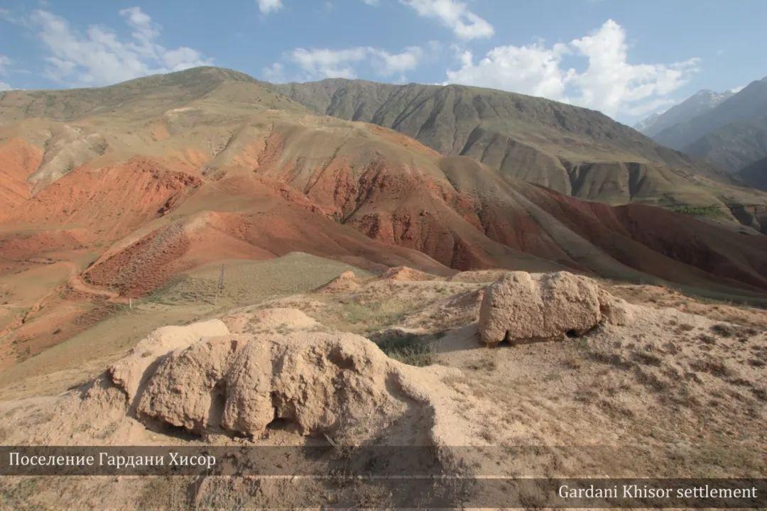
Silk Road: Zerafshan-Karakum Corridor “Gardani Khisor Settlement” (Source: UNESCO-IICAS)
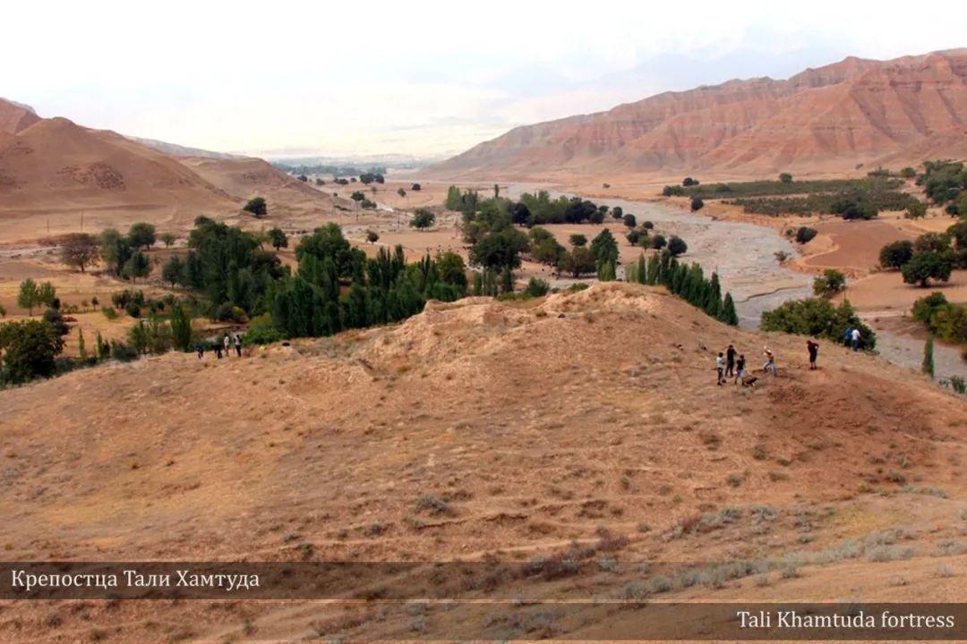
Silk Road: Zerafshan-Karakum Corridor “Tali Khamtuda Castle” (Source: UNESCO-IICAS)
The Silk Road: Zerafshan-Karakum Corridor is one of the most important sections of the Silk Road in Central Asia, connecting other Silk Road corridors in all directions. This 866-kilometer-long corridor consists of 34 heritage components spread over rugged mountains, fertile river valleys and uninhabited deserts, stretching from east to west along the Zerafshan River, and then southwest along ancient caravan routes through the desert to the Merv Oasis.
The distribution of the declared heritage components along the corridor through geographically diverse areas of uplands, foothills, steppes, oases, fertile valleys, and arid desert lands reflects the complexity of the landscape and demonstrates the adaptations of human societies to the control of Silk Road activities and trade. The natural conditions along the Silk Road varied greatly, from fertile valleys and deltas to deserts and river crossings, and human beings made different choices depending on the situation, as evidenced by the small towns, forts, and transit points along the route. The trade flows brought political and social capital, reflected in the degree of commercial development, social elites and religious architecture, among other things, as described in the declaration documents. It was a place where the most cosmopolitan character of the world's history, the Sogdians, flourished. For many of the empires along the Silk Road, including the Sut, Parthian, Sassanid, Timurid, and Seljuk dynasties, control of these corridors was crucial, as it was the basis for long-distance exchanges along the Silk Road.
Large quantities of goods and some high-value commodities from the East and the West were transported and traded along the Silk Road corridors, and many famous local specialties were transported from the region to satisfy the needs of distant populations. People traveled, settled, conquered or were defeated along the Silk Road corridor, which gradually evolved into a cradle of races, cultures, religions, sciences and technologies. During the historical period from the 2nd to the 16th centuries B.C., the Silk Road corridor experienced three phases of prosperity: the 5th to the 8th centuries A.D. - the rise of the Sutian merchants; the 10th to the 12th centuries A.D. - the development of a flourishing trade with the Muslim world and beyond; and the 13th century A.D. - the development of a trade with the Muslims and other regions of the world. thriving trade; and 13th to 17th centuries A.D. - the flourishing of science, culture, urban planning, and economy under Mongol rule.
Criterion (ii): The corridor of Zerafshan-Karakum illustrates the important exchanges and collisions of different human values that took place in the heart of Central Asia from the eighteenth century onwards, as reflected mainly in the architecture, monuments, urban planning, landscapes, arts and technologies of the heritage components, which reflect a distinctive and diverse blend of diverse multiculturalisms, ethnic traditions, beliefs and technologies. As one of the main sections connecting the centers of the Silk Road road network in multiple ethnic areas, the Zerafshan-Karakum corridor, which was once dominated by a number of great empires in the vicinity of the route, clearly demonstrates the diversity of populations, cultures and traditions, ideas and beliefs, as well as the knowledge and technologies associated with them.
Criterion (iii): Covered with rich artifacts resulting from the accumulation of history, the Zerafshan-Karakum corridor is a unique testimony to the socio-cultural traditions shaped by trade and exchange along the corridor. The wealth of the Sultanate merchants attests to this, with their luxurious residences, Sultanate temples with fire altars and frescoes, Achaemenid citadels, early Islamic mosques with large minarets, colorful Sufi architecture developed after the Arab conquests, advanced irrigation systems, and a wide range of mercantile and travel service facilities. These facilities were provided and maintained by the successive empires that controlled the corridor.
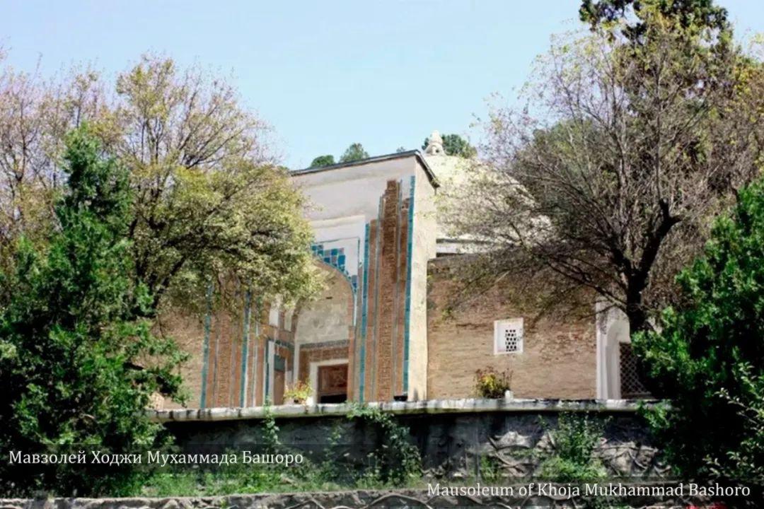
Silk Road: Zerafshan-Karakum Corridor “Mausoleum of Khoja Mukhammad Bashoro” (Source: UNESCO-IICAS)
Criterion (v): The Zerafshan-Karakum corridor is an outstanding example of traditional human settlement and land use, reflecting the interaction between humans and nature. The corridor territories, which include a variety of geographical areas such as plateaus, foothill zones, arid steppes, oases and fertile valleys, and arid deserts, are the basis for human town planning, architectural design, agriculture and other productive activities. The determination, initiative and original design of local people have transformed this barren land into a thriving and prosperous place.
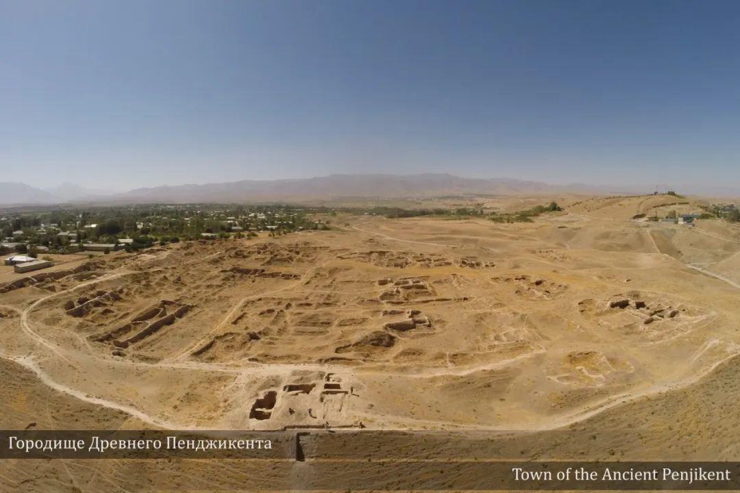
Silk Road: Zerafshan-Karakum Corridor “Ancient Penjikent Site” (Source: UNESCO-IICAS)
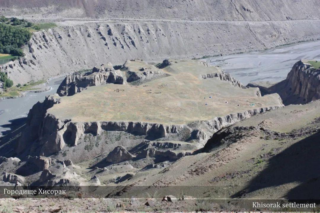
Silk Road: Zerafshan-Karakum Corridor “Khisorak Settlement” (Source: UNESCO-IICAS)
Integrity
The integrity of the heritage is reflected at two levels: at the level of the corridor as a whole and at the level of the heritage components. At the level of the Corridor as a whole, the form and function of the components, such as mausoleums, sardobas, caravanserais, minarets, mosques, religious complexes, settlements and remains of the old towns, are characterized by their diversity, demonstrating the positive role that the Corridor has played in its history as a road section, not only in linking the other corridors, but also in facilitating the trade in goods with the local communities. As a whole, the heritage series also demonstrates the state of exchange of ideas and knowledge along the Silk Road as a result of the movement of people and goods. At the level of heritage components, all the necessary attribute features that convey the outstanding universal value of the heritage are reflected in the heritage. Factors affecting heritage, such as development pressures, are largely within the control of States Parties.
Authenticity
Both the Corridor as a whole and each of the heritage components demonstrate the authenticity of the heritage. At the level of the Corridor as a whole, the alignment of the Silk Road route, its geography, and the landscape environment that shaped the Corridor have remained largely unchanged over time. At the level of the heritage components, the location, planning and layout of the heritage have also remained the same. Many sections of the highway are still used for transportation as they were in the past, and most of the religious buildings and cemeteries still serve their original functions. Many of the archaeological sites have been excavated and backfilled to protect the heritage materials from deterioration. The vast majority of these remain untouched, providing opportunities for future research and the recovery of authentic data. The original materials and design can be seen on most of the buildings. Conservation measures carried out on the buildings also follow internationally recognized principles, such as the principle of least intervention. In the case of reconstruction for the purpose of heritage interpretation, the reconstructed parts were distinguished from the original structure and materials.
Silk Road: The geographical scope of the “Zerafshan-Karakum Corridor” is: along the broad watershed of the Zerafshan River to the Karakorum Desert. In the ICOMOS Thematic Study on the Silk Road, it belongs to the 4th and 5th of the 54 corridors. It is connected with the Tien Shan corridor in the north, the Ferghana Valley corridor in the east, the Amu Darya corridor in the south, the Caspian Sea corridor in the west via the southern part of the Aral Sea, and the Khorasan corridor via Merv. The corridor begins at Khisorak in the Sogd province of the Republic of Tajikistan and ends at Kushmeihan in the Mare region of Turkmenistan. The corridor is characterized by rugged mountains in the east, the fertile oases of Sogdiana in the center, the Amu Darya River in the west, the Karakorum Desert, and the oases of the lower Murgab River. The total length of the corridor is 866 kilometers, and it traverses the geographic areas of plateaus, foothills, plains, irrigated areas, oases, steppes and deserts. Of the three countries to which it belongs, the mountainous areas are mainly in Tajikistan, the plains are in Uzbekistan and the desert area across the Amu Darya belongs to Turkmenistan.
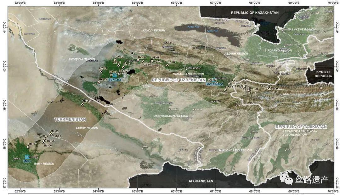
The declared heritage sites are categorized into five types according to their historical functions: central towns and trading settlements, field settlements, transportation and defense facilities, religious sites, irrigation systems and water supply sites.
Among them, the center town and trading settlement:
Sanjarshakh, 5th to 9th centuries AD.
Town of Penjikent, 5th to 8th centuries AD.
Kafirkala Settlement, 1st to 9th centuries AD; Dabshiya Settlement, 5th to 8th centuries AD; Kafirkala Settlement, 1st to 9th centuries AD; Kafirkala Settlement, 1st to 9th centuries AD.
Dabusiya Settlement, 6th to 19th centuries BC; Kafirkala Settlement, 1st to 9th centuries AD; Dabusiya Settlement, 6th to 19th centuries AD.
Vardanze Settlement, 4th to 13th centuries AD.
Varakh-Sha Settlement, 2nd century BC - 11th century AD.
Paikent Settlement, 4th to 13th centuries B.C.E.; Amur Settlement, 2nd to 11th centuries A.D.
Amul Settlement, 1st to 19th centuries AD; Kushmeihan/Dinli Kishman, 2nd to 13th centuries AD.
Field Settlements:
Khi-sorak, 1st to 10th centuries AD.
Kum Set-dement, 7th to 8th centuries AD.
Gardani-Khisor, 7th to 8th centuries.
Transportation and defenses:
Castle on Mount Mugh, 7th-8th centuries AD.
Tali-Khamtuda site, 2nd-1st centuries BC, 1st-3rd centuries AD, 10th-12th centuries AD.
Raboti Malik Post (and Cistern) (Raboti Malik Caravanserai), 11th-12th centuries AD.
Mansaf Caravanserai, 11th-12th centuries AD; Mansaf Caravanserai.
Konegala Caravanserai, 11th-12th centuries AD; Mansaf Caravanserai, Konegala Caravanserai.
Tahma-laj, and Akhyagala.
Akj a Gala Caravanserai, Konegala Caravanserai, Tahma-laj, Akj a Gala Caravanserai, Konegala Caravanserai
Gyzylj a Gala Caravanserai, 8th-13th centuries AD.
Religious monuments:
Mukham-mad Basharo Mausoleum, 11th to 14th centuries AD.
Jartepa II Temple, 5th to 8th centuries AD.
Suleimaytepa Monastery, 1st-9th centuries AD.
Qosim Shaikh Complex, 16th-20th centuries AD.
Mir-Sayid Bakhrom Mausoleum, 11th century AD.
Deggaron Mosque, 11th century AD.
Chasma-i Ayub Zhazira, 13th century; Vobkent Minaret, 12th century.
Vobkent Minaret, 12th century AD.
Bahouddin Naqshiband Architectural Complex, 16th to 19th centuries AD.
Chor Bakr Necropolis, 14th century.
Remains of irrigation system and water supply:
Toksankoriz Irrigation System, 5th-8th centuries AD, 10th-12th centuries AD.
This corridor is another Silk Road project successfully inscribed on the World Heritage List, following the road network of the Chang'an-Tian Shan corridor in 2014. After more than a decade of joint multinational efforts, today's results are finally tangible, congratulations to Tajikistan, Turkmenistan and Uzbekistan!